December 2019 –
We have started to map the XC Ski and Snowshoe trails using an on-line mapping tool. Bring this up on your phone and it will even geolocate your position on the map respect the trails. We are just starting to add trails to this map. Please send any GPX files to us and we can add your favorite XC ski or Snowshoe trip this map.
- New on-line map and tools to help find your XC ski and Snowshoe trails.
- Click here to view new on-line map
Routes on this map include so far:
- Dodge Ridge – to South Wall Overloop – Snoeshoe only route – Very steep in sections – about 3 miles roundtrip
- Crabtree Loop – Marked ski trail loop near Dodge Ridge -4 miles roundtrip
- Pinecrest Campground track loop – 1.6 miles – Great loop to do as a circuit training loop
Old Maps from 2011 – Not all of these routes are that accessible! Please use new map above
The Pinecrest Cross Country/Snowshoe network map is a work in progress. Routes shown on the map are just conceptual at this point but could form the basis of a set of routes to help develop the community of XC ski and snowshoe user network. Please provide your input on this map so we can continue to develop and refine the routes to best create this new community network.
Below are also two XC ski area maps that show XC trails near Dodge Ridge and Herring Creek Rd off of Hwy 108.

Pinecrest Cross Country Ski and Snowshoe Network Conceptual Map Nov 2011
Other Cross Country Ski maps
Map #1 XC ski options on Crab Tree or Gooseberry Rd next to Dodge Ridge
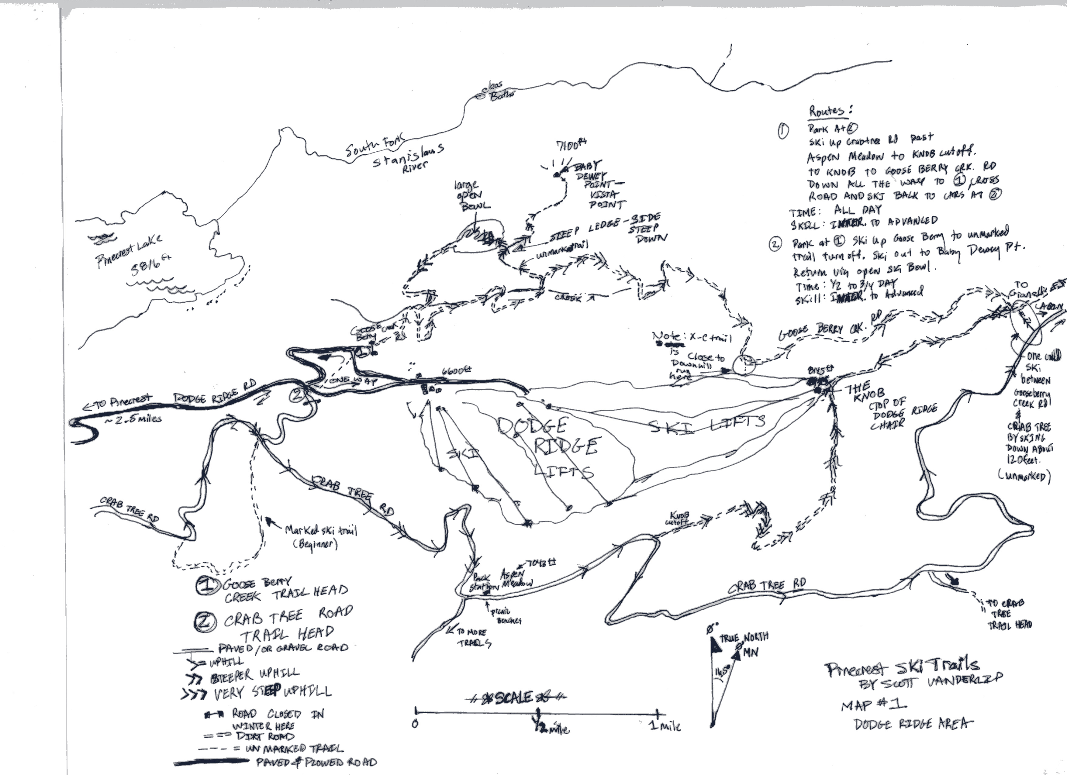 Ski options next to Dodge Ridge (Click to view full size)
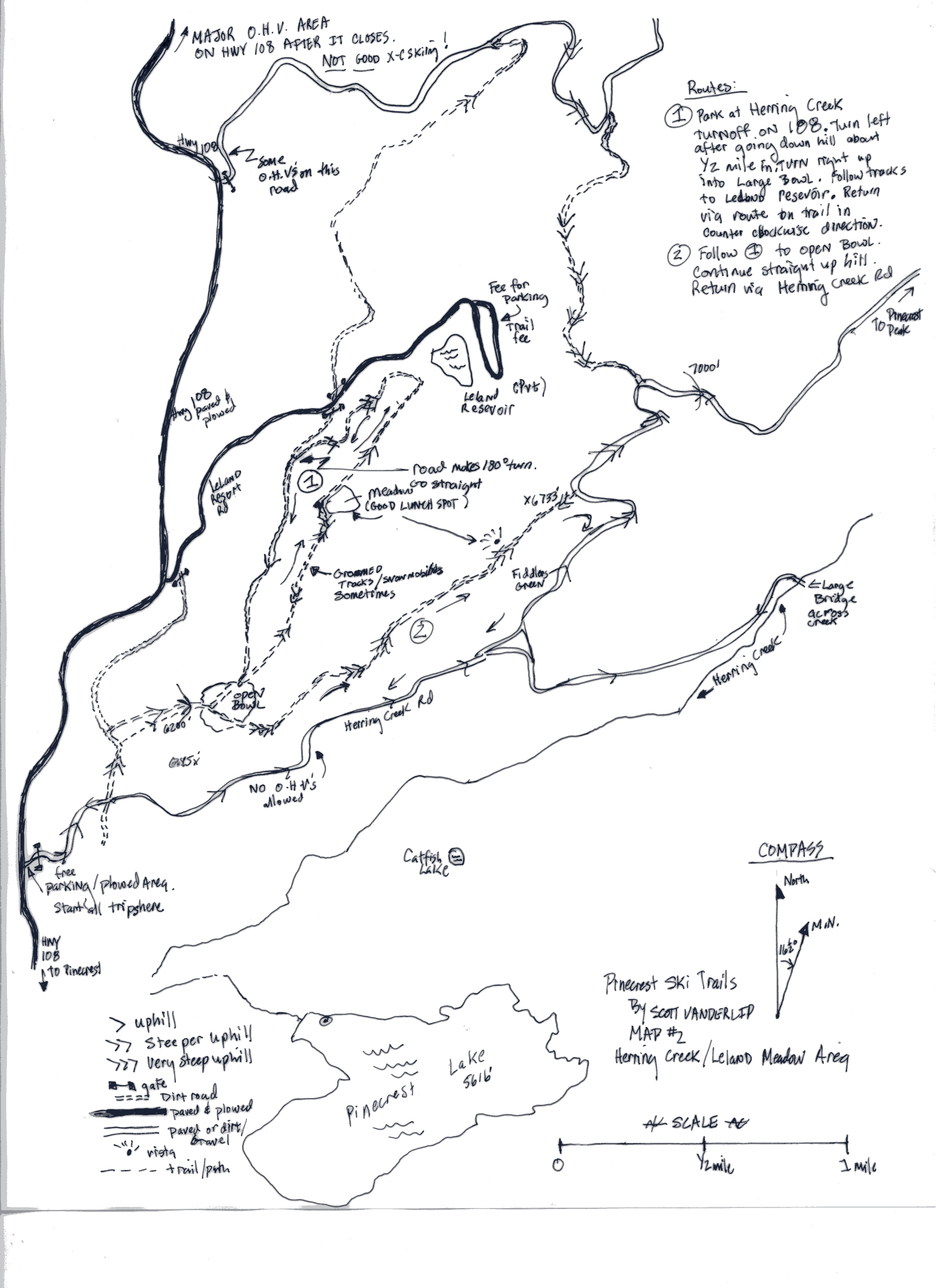
XC Ski options on the Herrring Creek Rd (About 3 miles from Pinecrest on Hwy 108)
